 Hidalgo Falls, Brazos River
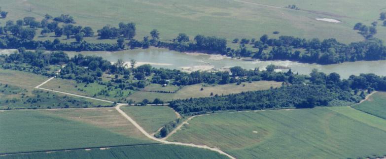
These photos were taken by Bryan boater James Williams as he flew over Hidalgo Falls on the Brazos and the adjacent TRPA property. Text is by Steve Daniel.
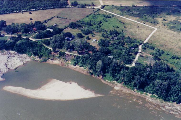
Looking west to the river. Lots have changed in the twenty years since TRPA bought the Hidalgo property in 2001 (when this photo was taken). The road coming into the property from the bottom of the photo is now blocked by a locked gate just before it branches to the left and right. The TRPA property starts inside the gate. We used to own the property where the road in the photo extends to the left of the gate, but we sold that property in 2003 to acquire more of the property in the center of the photo (including property along the river where much of the rapid is located). We put in a road from the gate down along the fence line straight to the river, and now own six acres (including along the river from the fence line upriver to the right). We also own the rectangle-shaped wooded area in the middle/ right of the photo.
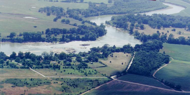
From this angle you can see the thickly forested, seven-acre TRPA tract on the right. The TRPA property includes much of the open field in the center of the photo, but we no longer own land south (to the left) of the line between the curve in the main raod and the river.
The V-shaped road in the foreground used to be part of a 2.9 acre tract owned by TRPA, but it was sold in November 2003 to acquire four acres closer to the rapid. Access to the rapid is now by means of a new road on the right built along the fence line running from the gate straight to the river. However, we can still access the upper put-in using the road on the far right which swings around to run alongside the river down to the rapid.
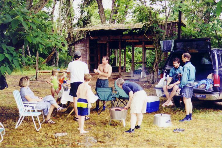
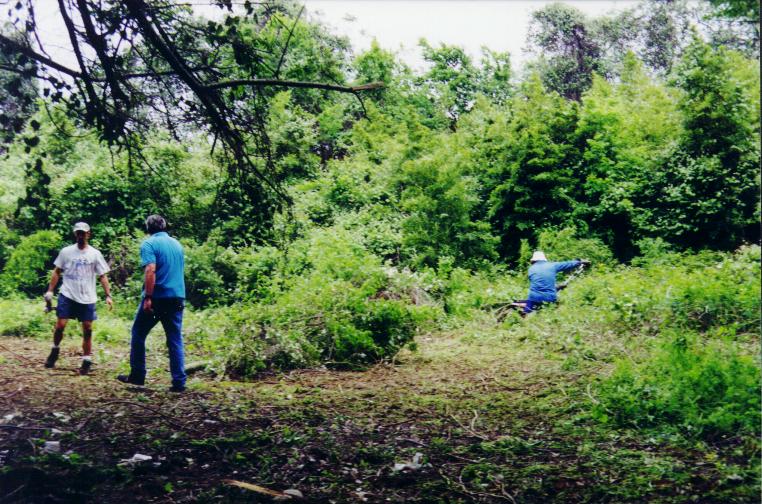
The ramshackle pavilion shown below, where we held our May 5, 2001 grand opening party, is no longer on TRPA property.
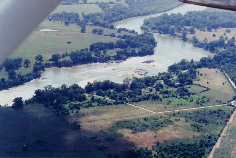
The TRPA property begins roughly where the part of the rock creating the rapid contacts the bank. As the next photo indicates, the property is about 30 feet above the river at normal water levels. In this photo, you are looking back at the entrance gate, and the TRPA property line is from the gate, along the fence, to where the rock is exposed in the river. The property includes all of the open field between the road on the top left and the river.
The major portion of the rapid is upstream from TRPA land. In order to put in above the rapid, we have permission from the Orlandos to put in to the river upstream from the white building in the trees. From there you can float down to the rapids for surfing. In this photo, the upper island had been covered by logs which are now gone. If you don't want to run the rapid, you can carry your boat up along the side of the river to the surfing spot (marked by the wide V-shaped curler wave). Two sloping paths lead down to the river from TRPA property.
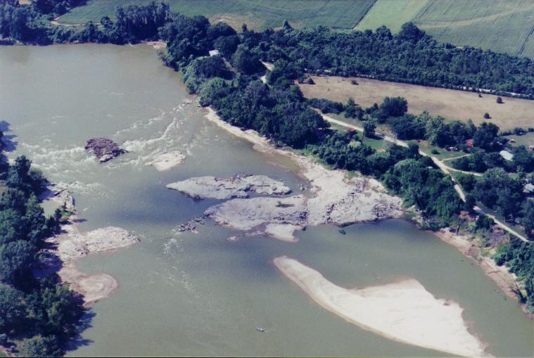
Between 15' and 16' on the Bryan gauge (when this photo was taken) the large sandbar near the lower property dwarfs the johnboat in the middle of the river (bottom of photo). At slightly higher levels, the tail waves at the bottom of the rapid can be 5' high and are great for fast surfing. Side-surfing holes are immediately downstream from the rocks on river left (the sandbar's upstream finger is pointing right at the holes). More surfing waves and holes are upstream far river right (left of photo) and between the debris-covered upper island and the river left shore. The island to the river left side and downstream of the first island has some great squirt and cartwheel eddy lines on the river left side. At the pointed tip of the next island downstream is the "ender please" wave, where enders can be found even though the wave does not look like it would be a good spot for them. Because of the upstream ledges, there is a large eddy on river left above the ender please spot.
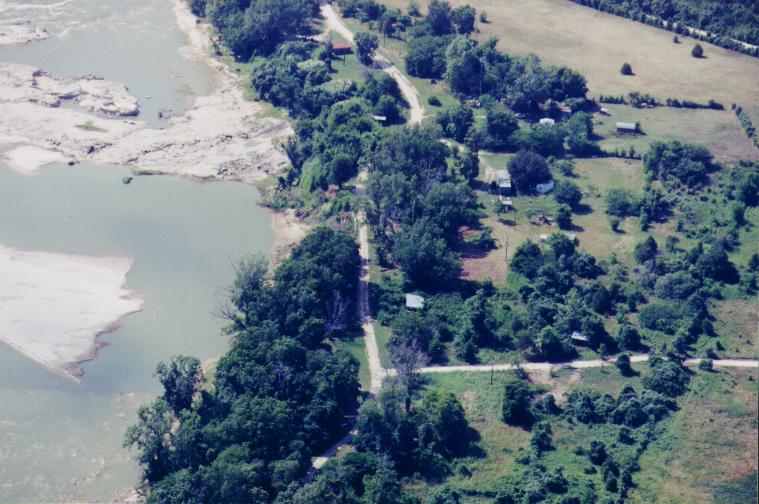
The access road to the upper put-in is visible in the upper right of the photo. We can drop our boats off but cannot park our vehicles there. Or, you can carry your boats up to the put-in on the access road.
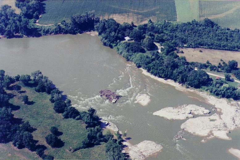
The bamboo thicket is the lighter green vegetation on the shore near the house in the photo. This is on Orlando property, but we have an access easement to carry our boats up up the trail through the bamboo thicket to the road.
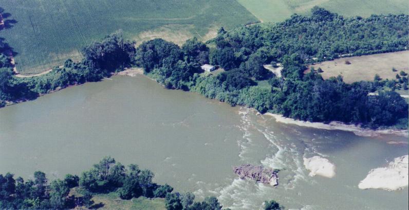
At lower water levels (e.g., 11'-13' on the Bryan gauge), playboaters head for the ledges on far river right. At higher levels, boaters typically head to the surfing holes to the left of the top (debris covered) island. (The debris is now gone.) After playing throughout the entire rapid, you can get back up to the bamboo trail easily using the large eddy on river left.
We used to have an upper parking lot (with crushed rock) at the north end of seven-acre wooded area that could accommodate 12 vehicles. It was only 50' from access to the Slide. We put a lot of effort into clearing it of thick stands of poison ivy, vines, and bamboo. Nature has now reclaimed it.
The Slide, a 35' steep incline boaters often used to access the river, is in the lighter green area upstream of the house on the bluff near the bend in the river. You ccould go down the Slide frontwards or backwards. The river has now eroded the side of the Slide so much that most of its upstream side is gone. Unfortunately, the Slide is now a feature of Hidalgo Falls' past.